Selected
- Details
- Written by NSW News
- Category: Selected
- Hits: 306
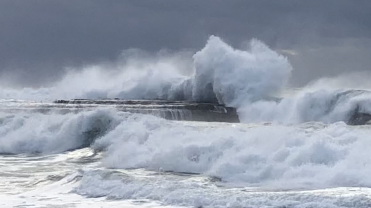
The Weather Bureau has issued a severe weather warning for damaging surf hitting much of the NSW Coast on Sunday.
It says a trough of low pressure will move up the NSW coast overnight Saturday and on Sunday morning bringing fresh to strong southeasterly winds and driving very heavy surf from the southeast.
It might lead to localised damage and coastal erosion.
Significant wave heights greater than five metres and peak period around 12 to 15 seconds are expected to develop along the South Coast before dawn on Sunday then extend northwards.
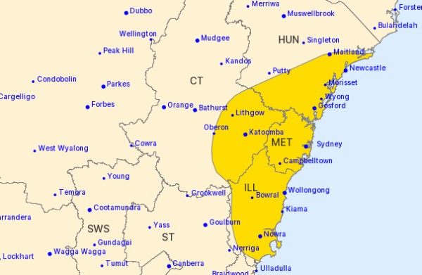
Areas impacted include exposed south and southeast facing coasts of the South Coast, Illawarra, Sydney Metropolitan, and Hunter forecast districts, and the far south of the Mid North Coast forecast district.
Beach conditions in these areas could be dangerous and people should stay well away from the surf and surf exposed areas.
A separate Hazardous Surf warning is also current and expected to continue until Monday.
Locations which may be affected include Newcastle, Sydney, Wollongong, Batemans Bay, Eden, Moruya Heads, Narooma and Merimbula.
The State Emergency Service advises that people should stay vigilant and monitor conditions.
Image: Glenn Ellard
- Details
- Written by Grant Broadcasters
- Category: Selected
- Hits: 318

Evasive new Omicron variants are fuelling a rise in COVID-19 cases and hospitalisations in Australia, but experts say it is too early to know if they cause more severe disease.
Australia posted 41,866 new cases and 35 deaths on Friday - the third day in a row of 40,000-plus daily infections - as the BA.4 and BA.5 strains overtake the BA.2 sub-lineage as the dominant Omicron variants.
The number of people hospitalised with the virus has risen to 3977, up by more than 1000 in the past fortnight.
Deakin University epidemiology chair Catherine Bennett said it was difficult to determine how transmissible the new variants were compared to previous strains due to waning vaccine immunity and differing levels of prior infection.
The new strains had made everyone "fair game" for either infection or reinfection, but hospitalisations were unlikely to reach levels seen during the initial Omicron wave, she said.
Preliminary research from Japan has indicated the variants could replicate more efficiently in the lungs than BA.2, and Prof Bennett said this could lead to an increase in lower respiratory tract and secondary infections.
"It's not like saying that's going to increase our death rate, but it could as secondary infections become harder to manage," she said.
Increasing cases have led to calls from some experts to reintroduce indoor mask mandates in an attempt to curb transmission, a measure state health officials have also discussed.
However, Prof Bennett said she did not believe compulsory mask-wearing should be reintroduced and instead encouraged authorities to re-engage with the COVID-fatigued community with targeted public health messages.
Based on her analysis of NSW data, she said the current risk of encountering an infectious person in a public place was somewhere between one in 25 and 50.
"It just makes you think, 'I'm in a store and it's probably got 25 people in it ... I'm putting a mask on so I don't give it to anybody else and I don't get it from them'," she said.
From Monday, Australians over 30 will be able to get a fourth vaccine dose - or second booster - after the Australian Technical Advisory Group on Immunisation expanded eligibility amid the case spike.
- Details
- Written by NSW News
- Category: Selected
- Hits: 285
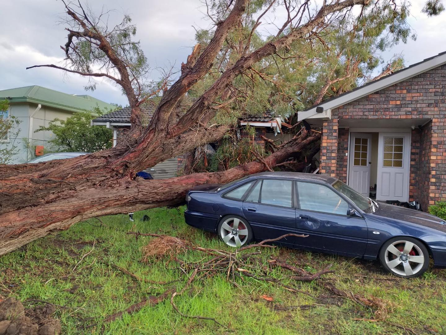
Damaging winds averaging 65 km/h with peak gusts in excess of 90 km/h are likely along the NSW coastal fringe, most likely during Sunday afternoon and evening.
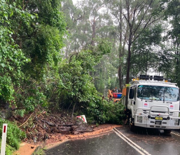
Heavy rainfall will further contribute to flooding already being experienced, and increases the potential for landslides.
The damaging winds may lead to debris on roads and provides the risk for trees toppling in softer soils.
The State Emergency Service advises that people should:
* Move vehicles under cover or away from trees.
* Secure or put away loose items around your house, yard and balcony.
* Keep at least 8 metres away from fallen power lines or objects that may be energised, such as fences.
* Trees that have been damaged by fire are likely to be more unstable and more likely to fall.
* Report fallen power lines to either Ausgrid (131 388), Endeavour Energy (131 003), Essential Energy (132 080) or Evoenergy (131 093) as shown on your power bill.
* Don't drive, ride or walk through flood water.
* Keep clear of creeks and storm drains.
* If you are trapped by flash flooding, seek refuge in the highest available place and ring 000 if you need rescue.
* Be aware that run-off from rainfall in fire affected areas may behave differently and be more rapid. It may also contain debris such as ash, soil, trees and rocks.
* After bushfires, heavy rain and the loss of foliage can make the ground soft and heavy, leading to a greater chance of landslides.
* Stay vigilant and monitor conditions. Note that the landscape may have changed following bushfires.
* For emergency help in floods and storms, ring your local SES Unit on 132 500.
Images: Newsroom
- Details
- Written by NSW News
- Category: Selected
- Hits: 324
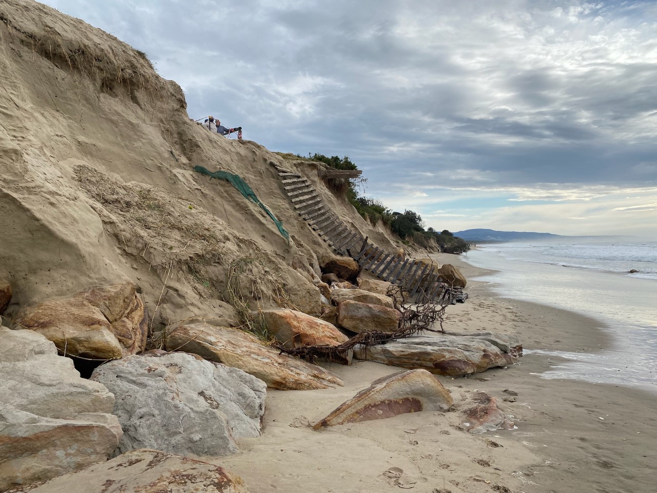
Very heavy surf is likely to develop during today, persisting into Monday, which may lead to localised damage and coastal erosion.
Conditions are expected to ease during Monday afternoon.
Peak wave heights are expected later this evening and may coincide with evening high tides after 10pm.
Areas impacted may include exposed coasts of the Hunter, Metropolitan and Illawarra and Shoalhaven.
Significant wave heights of over 5m are possible with peak periods around 11 seconds.
Wave directions will be from the East and South East.
Beach conditions in these areas could be dangerous and people should stay well away from the surf and surf exposed areas.
Warnings for other phenomena are also current for these areas.
Locations which may be affected include Newcastle, Gosford, Wollongong, Albion Park, Kiama and the Shoalhaven Coast.
Image: Peter Andrea
Page 24 of 191