
The main flood peak along the Hunter River is now at Singleton where moderate flooding is occurring.
Minor flooding is occurring along the Hunter River at Maitland where river levels are expected to peak below the moderate flood level Monday morning.
Lower Hunter:
Moderate flooding is occurring at Singleton and minor flooding is occurring at Maitland.
The Hunter River at Singleton is currently at 12.71 metres and near its peak with moderate flooding.
The Hunter River at Maitland (Belmore Bridge) may peak around 8.40 metres Monday morning with minor flooding.
What we are expecting:
-
New England Highway (A15) (north of Singleton Township) likely to be closed between Bridgman Road and White Avenue , use alternative route
-
At Maitland: (Belmore Bridge)
-
The Singleton Caracourt Caravan Park and Wyland Caravan Park may experience some low-lying inundation
-
Scotts Flat Road closes south of Pankhurst Bridge isolating homes
-
Putty Road, 700 metres south of John Street high-level bridge over the railway line. This closes the secondary access between Singleton and Sydney and Whittingham
-
Combo Lane to Pidgeon Point may become isolated
-
Glendon cut off from direct access to Singleton; alternative route open via Sedgefield and Roughit Lane
-
Inundation of low-lying properties in Doughboys Hollow and Whittingham
-
Possible overtopping of the river at Scotts Flat area leading to the isolation of properties
-
Putty Road at Doughboy Hollow, Army Camp Road at Glenridding may close
-
All Riverside park access is closed
-
Bridgeman Road Singleton may close
-
East Singleton may be impacted by minor road closures including, Dangar Road, Greenwood Avenue, Whitefalls Lane, Haggarty Lane, Netsfeild Lane, Kanoona Lane, Racecourse Lane
-
Road to Jerrys Plains (Golden Highway) will close
-
Bridge over Redmanvale Creek, south-east of Jerrys Plains on Golden Highway may be closed
-
Possible isolation of Whittingham area
-
Bridge over Hunter River near Coolmore Stud (approx. 8kms north west of Jerrys Plains) on Golden Highway may close
-
At Singleton: (Donolly Bridge)
-
Stanhope Road cut at Kilfoyles Bridge between Luskintyre Road and Lambs
-
Valley Road. Alternate route via Branxton and Stanhope
-
Windermere Road at Windermere is cut just past Windermere House
-
Brush Farm Road and Pitnacree Road, Pitnacree (East Maitland) closed with Low lying farmland is inundated.
-
Maitland Vale Road at Rosebrook may close
-
Water up to the back of buildings in Swan Street, Morpeth on the riverside. What you need to do:
-
People in areas likely to be impacted by flooding in and around Singleton should prepare for potential isolation and possible evacuation
-
People in areas likely to be impacted by flooding in and around Maitland should prepare for potential isolation and possible evacuation
-
Do not drive, ride or walk through flood water
-
Farmers on low lying land close to rivers and creeks are urged to monitor livestock, pumps, and other equipment. Waste and chemical containers should be located well above predicted flood levels.
-
Residents of low-lying areas near the river should keep an active watch on the floodwaters.
-
Keep in contact with your neighbours.
-
Consider impacts of possible road closures on work, family and educational commitments.
-
Monitoring emergency warnings and severe weather updates on local ABC radio, NSW SES Hunter Facebook Page and Bureau of Meteorology website.
-
If you live in a low-lying area and are advised by an emergency services officer to evacuate, please do so.

In life-threatening situations call triple zero (000) immediately.
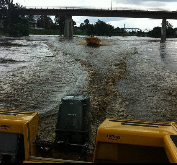
Images: Hunter SES Facebook