A cold front is moving off the east coast this morning.
Vigorous westerly winds behind this front are extending across the east, continuing this evening and easing into Monday morning.
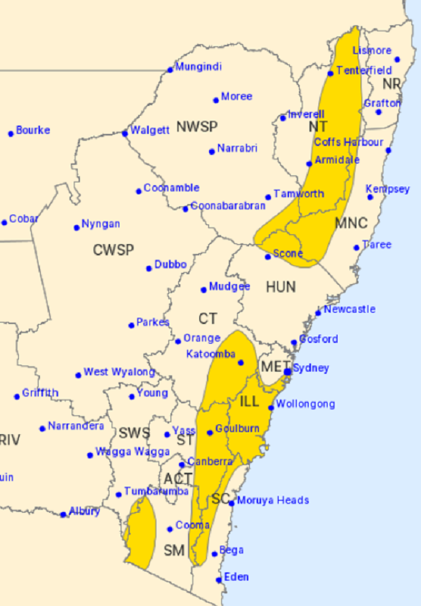
Wild weather bringing DAMAGING WINDS are expected along the state's east coast and into the highlands today.
Winds between 60 to 70 km/h with peak gusts in excess of 90 km/h are likely over the Alpine, South West Slopes, the Blue Mountains, Illawarra, and elevated areas of the Southern Tablelands, South Coast, Northern Tablelands, Hunter, and Mid North Coast.
DAMAGING WINDS are also possible through the southern and eastern suburbs of the Sydney Metropolitan district.
Things should ease off later tonight or early Monday morning as the cold front moves further into the Tasman Sea.
BLIZZARDS above 1500 metres with blowing snow.
NSW National Parks and Wildlife recommends that back-country travel be postponed until conditions improve.
Image: Bureau of Meteorology